advertisement

1
1 ActiveXperts Hydromagic 7.0
Introduction
Hydromagic is an hydrographic survey software tool, which can be used to map areas using a GPS and echosounder. Use the software to import, view and edit your maps, display your position and to record depths (create soundings). The software will work with almost any GPS and echosounder, and can be used on any desktop, laptop or netbook computer running Windows 7 or higher.
The software has been tested successfully on the following operating systems:
Windows 7-32 bit;
Windows 7-64 bit;
Windows 8-32 bit;
Windows 8-64 bit;
Windows 8.1-32 bit;
Windows 8.1-64 bit;
Windows 10-64 bit.
Since version 7.0 there is also the possibility of monitoring dredge operation.
In order to use these features, you need to purchase the Hydromagic Dredging edition as well.
Some application examples:
Record depth data using a GPS and echosounder;
Show your current position and depth on a loaded map;
Convert your soundings to a regularly spaced XYZ data (DTM);
Convert your soundings to different file formats;
Show cross-sections and calculate volumes;
Design and generate theoretical DTM's (channel design);
Create depth contours and save them as ESRI shape files;
Add comments, symbols or routes to your maps;
Perform real time positioning on research and hydrographic survey vessels;
Fishing industry, for instance to navigate inside the assigned fishing parcels;
View GIS features on shape files, CAD and S57 (ENC) data;
1.1
Supported Hardware
Supported Hardware
The list below is just an indication, the software will probably work with more models then the ones that are displayed below.
Supported Echosounders
NMEA0183 Compatible Echosounders;
Cee Hydrosystems Ceestar;
Cee Hydrosystems Ceeducer pro;
Elac Hydrostar LAZ4300;
Elac LAZ4100;
Elac STG 721C;
Innerspace Technologies 440S;
Simrad EA200 series;
Simrad EA300 series;
Simrad EA400 series;
Simrad EA500 series;
Simrad EA600 series;
STN Atlas Deso 11;
STN Atlas Deso 14;
(C) 2015 ActiveXperts Software B.V.
Introduction 2
Innerspace Technologies 448;
Innerspace Technologies 449;
Innerspace Technologies 455;
Innerspace Technologies 456;
Knudsen 320 series;
Navitronic Navisound 2000;
SyQwest Bathy 500DF;
SyQwest Bathy 500MF;
SyQwest Bathy 1500C;
Ohmex SonarMite;
Odom DigiTrace;
Odom EchoTrac DF3200 MK II;
Odom EchoTrac MK III;
Odom EchoTrac CV100;
Odom EchoTrac CV200;
Odom EchoTrac CV300;
Odom EchoTrac CVM;
Odom HydroTrac;
Odom HydroTrac II;
Supported GPS Receivers
NMEA0183 Compatible GPS Receivers;
NMEA0183 Compatible DGPS Receivers;
NMEA0183 Compatible RTK Receivers;
Garmin USB GPS receivers using the PVT protocol;
Trimble RTK Receivers;
Supported Tide Receivers
MGB Tech MTU821-D;
MGB Tech MTU821-W;
Ohmex TidaLite;
Vyner MK2;
Supported AIS Receivers
AdvanSea AIS RX-100;
Digital Yacht AIS100;
Digital Yacht AIS200PRO;
Digital Yacht AIS200N2K;
Digital Yacht ANT200;
Digital Yacht iAIS;
EuroNav AIS-2-NMEA;
EuroNav AIS-2-USB;
Furuno FA30;
Icom MXA-5000;
Nasa AIS Engine 1;
Nasa AIS Engine 2;
Nasa AIS Engine 3;
Smart Radio SR161;
STN Atlas Deso 15;
STN Atlas Deso 17;
STN Atlas Deso 20;
STN Atlas Deso 22;
STN Atlas Deso 25;
STN Atlas Deso 30;
STN Atlas Deso 35;
STN Atlas Deso 350M;
Reson Navisound 110;
Reson Navisound 205;
Reson Navisound 210;
Reson Navisound 215;
Reson Navisound 420;
Reson Navisound 630DS;
Unabara Hydrobook
(C) 2015 ActiveXperts Software B.V.
advertisement
Related manuals
advertisement
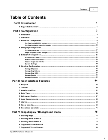
Table of contents
- 4 Introduction
- 4 Supported Hardware
- 6 Configuration
- 6 Installation
- 7 Activation
- 9 Hardware Configuration
- 9 Configuring NMEA0183 hardware
- 16 Configuring hardware using plugins
- 20 Dredging Configuration
- 20 Dredging hardware
- 21 Single segment cutter dredger
- 24 Software Configuration
- 24 Echosounder Offset
- 26 Motion sensor calibration
- 28 Vessel shape and offsets
- 32 System Settings
- 35 Geodesy Configuration
- 35 Manage Ellipsoids
- 37 Manage Map Datums
- 40 Manage Map Grids
- 43 Manage Geoids
- 45 Manage Countries
- 47 User Interface Features
- 47 Projects
- 53 Toolbar
- 54 Accelerator Keys
- 56 Data View
- 60 Helmsman Display
- 63 Area Measurements
- 65 Alarms
- 72 Query objects
- 74 Coordinate calculator
- 78 Map display / Background maps
- 78 Loading Maps
- 80 Loading IHO S-57 ENC's
- 81 Loading IHO S-63 ENC's
- 86 Supported Raster Formats
- 86 Supported Vector Formats
- 87 Downloading Maps
- 91 Changing drawing order
- 92 Adding waypoints to the map
- 96 Projecting Waypoints
- 99 Adding comments to the map
- 103 Adding photos to the map
- 107 Creating Boundaries
- 110 Cross Sections
- 113 Cross Sections from CAD
- 117 Channel Design
- 121 Recording Data
- 121 Getting Started
- 122 Creating a new singlebeam sounding
- 125 RTK Tides
- 130 Singlebeam Processing
- 130 Getting Started
- 131 Selecting Files
- 132 Tide Correction
- 134 Tide File Editor
- 139 Draft and Sound Velocity
- 142 Correcting Data
- 144 Filter Data
- 146 Echogram Editor
- 148 Position Editor
- 151 Miscellaneous Tools
- 152 Apply Offsets
- 154 Reproject Positions
- 156 Unit Conversion
- 157 Table Editor
- 160 Generate Soundings
- 163 Importing Soundings
- 165 Importing Soundings from NMEA0183 log
- 168 Exporting soundings
- 171 Post Processing
- 171 Generate and Display Matrix
- 176 Generate Matrix from Sections
- 179 Generate Matrix from CAD
- 183 Generating Contours
- 186 Volume Calculation (Matrix)
- 189 Volume Calculation (Stages)
- 192 Volume Calculation (Sections)
- 197 Entering Shoreline Data
- 201 Export to Google Earth
- 206 Export to AutoCad
- 210 Export current view
- 213 Utilities
- 213 License Updater
- 216 Geoid Converter
- 218 Plugins
- 218 Hydromagic Simulator Plugin