advertisement

213 ActiveXperts Hydromagic 7.0
8.2
Geoid Converter
Geoid Conversion
The "Geoid File Conversion Utility" is a freeware utility which can be used to convert geoid files between different formats.
The utility is shipped with Hydromagic, but can be used as a stand alone tool as well.
The main goal of the software is to enable Hydromagic users to convert their geoid files to a format which can be read by the Hydromagic software.
There are so many different geoid file formats around that we decided to use our own format, and create an external tool to get files converted to our internal format.
The following geoid file formats are supported (both reading and writing):
Hydromagic Geoid File Format (GEO Files);
Trimble Geoid File Format (GGF Files);
Carlson Geoid File Format (GSF Files);
US National Geodetic Survey (NGS) File Format (BIN Files);
Natural Resources Canada Files (BYN Files);
Surfer V6 Binary Grid Files (GRD Files);
ASCII Geoid Files.
Geoid Converter
The tool is installed in the "Program" folder under the installation folder of the software.
It can be started using Windows Explorer, or by locating the software under the Windows Start Menu.
(C) 2015 ActiveXperts Software B.V.
Utilities 214
Converting Files
Converting geoid files with the Geoid File Conversion Utility is very straightforward. All you have to do is to select a source and destination format.
You can use any combination of source and destination formats (although it doesn't make sense to set the source and destination formats to the same).
After selecting the formats, use the "Browse..." buttons to select an input and output file.
In order to use geoid files in Hydromagic, the destination file has to be written in the Hydromagic
"Geoids" folder which is selected by default.
For destination files other then the Hydromagic Geoid Files, you can select another location as well.
When done, click the "Start" button and the conversion process should start. Converting files usually only takes a couple of seconds.
ASCII Files
The Geoid File Conversion Utility supports two kinds of ASCII geoid files at this moment.
Because there is no real standard for ASCII geoid files, the supported files are described below:
ASCII Geoid Height Grid File (*.grd)
You should use this option for a file which contains a header value contained by separation values for each cell.
The header contains six values in the following order: South boundary, north boundary, west boundary, east boundary, vertical cell size and horizontal cell size.
27. 00000 36. 97500 - 14. 00000 - 0. 02500 0. 02500 0. 02500
52. 383 52. 342 52. 302 52. 257 52. 205 52. 147 52. 073
51. 978
(C) 2015 ActiveXperts Software B.V.
advertisement
Related manuals
advertisement
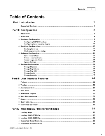
Table of contents
- 4 Introduction
- 4 Supported Hardware
- 6 Configuration
- 6 Installation
- 7 Activation
- 9 Hardware Configuration
- 9 Configuring NMEA0183 hardware
- 16 Configuring hardware using plugins
- 20 Dredging Configuration
- 20 Dredging hardware
- 21 Single segment cutter dredger
- 24 Software Configuration
- 24 Echosounder Offset
- 26 Motion sensor calibration
- 28 Vessel shape and offsets
- 32 System Settings
- 35 Geodesy Configuration
- 35 Manage Ellipsoids
- 37 Manage Map Datums
- 40 Manage Map Grids
- 43 Manage Geoids
- 45 Manage Countries
- 47 User Interface Features
- 47 Projects
- 53 Toolbar
- 54 Accelerator Keys
- 56 Data View
- 60 Helmsman Display
- 63 Area Measurements
- 65 Alarms
- 72 Query objects
- 74 Coordinate calculator
- 78 Map display / Background maps
- 78 Loading Maps
- 80 Loading IHO S-57 ENC's
- 81 Loading IHO S-63 ENC's
- 86 Supported Raster Formats
- 86 Supported Vector Formats
- 87 Downloading Maps
- 91 Changing drawing order
- 92 Adding waypoints to the map
- 96 Projecting Waypoints
- 99 Adding comments to the map
- 103 Adding photos to the map
- 107 Creating Boundaries
- 110 Cross Sections
- 113 Cross Sections from CAD
- 117 Channel Design
- 121 Recording Data
- 121 Getting Started
- 122 Creating a new singlebeam sounding
- 125 RTK Tides
- 130 Singlebeam Processing
- 130 Getting Started
- 131 Selecting Files
- 132 Tide Correction
- 134 Tide File Editor
- 139 Draft and Sound Velocity
- 142 Correcting Data
- 144 Filter Data
- 146 Echogram Editor
- 148 Position Editor
- 151 Miscellaneous Tools
- 152 Apply Offsets
- 154 Reproject Positions
- 156 Unit Conversion
- 157 Table Editor
- 160 Generate Soundings
- 163 Importing Soundings
- 165 Importing Soundings from NMEA0183 log
- 168 Exporting soundings
- 171 Post Processing
- 171 Generate and Display Matrix
- 176 Generate Matrix from Sections
- 179 Generate Matrix from CAD
- 183 Generating Contours
- 186 Volume Calculation (Matrix)
- 189 Volume Calculation (Stages)
- 192 Volume Calculation (Sections)
- 197 Entering Shoreline Data
- 201 Export to Google Earth
- 206 Export to AutoCad
- 210 Export current view
- 213 Utilities
- 213 License Updater
- 216 Geoid Converter
- 218 Plugins
- 218 Hydromagic Simulator Plugin